Saturday, February 29, 2020

Beit Guvrin to Bar Giora on Israel National Trail: Day 27

A day, mainly through woods and over scrub land, with an enjoyable visit to Tel Socoh (mainly owing to the food stall).
I woke sometime last night with a caterpillar or some other grub on my face, which I rapidly threw out of the tent, and a large spider on my sleeping bag. Insects in the tent have become a problem now the zip on my inner tent is broken.
My morning began with a walk over some hills on rough ground with large bushes disturbing several unsuspecting cows. In the forest that followed there was an observation platform but the weather was dull and overcast so not too good a view. I was intrigued by the name of the next section of woods which, for reasons not explained by the signs, was called the British or Britanya park. Numerous holes in the ground, covered with metal bars or surrounded by fences dotted today's trip, I took them to be sinkholes, a feature of the limestone rock. Crossing a broad,  flat bottomed valley there were a few fields and a large orchard glorious in pink and white blossom, petals blowing across my path in the wind. A few cars had stopped to admire it and take selfies with the blossom as a backdrop. 

Large orchard in blossom

A large group of cars had gathered at the bottom of a hill called Tel Socoh, causing a great deal of chaos in the small area as cars trying to come in were preventing cars trying to leave. There were a couple of stalls, one selling juice, freshly squeezed from either oranges or pomegranates, and the other selling a sort of tortilla or chipati covered with different things. I asked for one like the previous customer which involved covering the tortilla with sour cream, chopped onions and tomatoes and various condiments. It was then heated on the metal covering of a sort of enclosed brazier. Very enjoyable to eat with an orange juice. Tel Socoh is a hill with some ancient ruins on top (ancient ruins seem pretty common around here). Lots of people were climbing it - young, old, children and dogs (mostly on leads). Some had laid out a blanket for a picnic, others were photographing the flowers, which included lupins, the first I have seen in Israel.

Wild lupins

There followed many kilometres over scrubland and through woods along what a sign described as a green corridor. Excellent for wildlife, although I gained the impression from the terracing, building remains, olive trees and old orchards that this was an area once farmed by Arabs who had been moved out. Possibly some of those who tried to prevent convoys of food (and no doubt more lethal supplies) reaching the Jews trapped in Jerusalem during the 1948 war.
As darkness approached I pitched my tent in some woods near the village of Bar Giora, trying to damage as few of the pale pink cyclamens as possible.

Wild cyclamens

Friday, February 28, 2020

Philip farm to Beit Guvrin on Israel National Trail: Day 26

A day of walking through mainly agricultural land, Tel Lakish, an ancient palace fortress was the most significant location I visited.

Green fields, the Israel National Trail follows the farm track in the middle.

The morning took me through bright, green fields of some grain crop and lucerne. As it was the weekend groups of people were out walking. Some Israelis seem to walk the Israel National Trail a weekend or a few days at a time with a group of friends, slowly covering the length of the country. I also met a Dutch couple "through hiking" from the north and looking forward to the desert section. There were also convoys of 4x4s on the tracks, paragliders in the air, and motor bikes and quad bikes out for a weekend ride. Vineyards were added to the agricultural scenery, some with netting to keep the birds off. Apparently they grow grapes for the table in this area. A sign I passed stated I was now entering a firing range which was a little offputing, but the waymark painted on the sign clearly showed I was on the right path. Given that my map also showed the military area was to my right I continued on my way.

Warning of a firing range, but note the Israel National Trail waymark

I turned off the trail at Tel Lakhish, and viewed the remains of a gate house and the palace foundations. An historically significant outpost of the Kingdom of Judah, it fell to the Assyrians in around 700 BC who claimed to carry off 200,000 people (presumably as slaves) and again to the Babylonians a hundred years or so later. 

Entrance to Tel Lakhish

I continued to the village of Beit Guvrin, arriving too late to visit the Roman ruins. The shop at the Petrol station was open so I enjoyed a sandwich and welcome coffee among a crowd of bikers in full leathers, adorned with various brand names and some expensive looking motor bikes.
After Beit Guvrin I followed the edge of a wooded area. Large cacti and the remains of stone walls among trees means, I have read, that before the 1948 war an Arab village would have stood here. As I climbed into an area of dense bushes, I passed a Bedouin tent. Two young children playing nearby, wearing jumpers with teddy bear motifs, said "hello" as I passed. Their sheep were already penned for the night behind some wire netting. A few pickups were parked beside them.
Nearby I saw my first wild iris, pale blue and smaller than those in a florist's shop. These and all the red anemones looked particularly attractive in the low evening sun.

A wild iris

I settled on a small, but more or less flat area, among the bushes to pitch my tent for the night. Churned up by cows' hooves the ground was a little uneven but I could find comfortable positions to lie in. As I write this in my tent, some creatures are calling to each other with something more like repeated wailing than a howling or barking. A sign said this area has striped hyenas, maybe it was those, although it did not sound like they were laughing (later I decided its was Jackals). I was more concerned about why cars were driving along a nearby dirt track in the dark. Earlier I saw a police car, blue lights flashing, stop a car on these tracks. I try and keep a low profile.


Thursday, February 27, 2020

Sansana to Philip farm on Israel National Trail: Day 25

A good distance covered today on easy tracks through woods and across grassland by meandering, if dry, streams.
Leaving the hospitable village of Sansana I headed downhill through woods eventually reaching Lahav Kibbutz. I had thought of visiting the shop here but the yellow security gates had no pedestrian access, not wanting to get trapped inside, and as it was not essential to buy any groceries, I continued on my way. From the outside, many of the kibbutz and villages look unwelcoming, surrounded by high fences and closed gates.
The next section was up and down over grassy hills. Palm cave was on the path, so called as it is a cave, and it has a palm tree in front of it. Another pine woods followed. Sheep grazed in grassy areas covered with red anemones, while white egrets(?) wandered among them, sometimes standing on top of a sheep. At a picnic area there were remains of what looked like ancient cisterns for storing water.

Sheep grazing in a clearing among the red anemones

Walking beside a dry stream bed on the right populated with trees, and green crops on the left.

For a several kilometres the path followed a stream bed as it meandered about. Although there was little water the small valley was full of lush, green grass, herbage and a variety of trees. People were cutting the grass and loading it onto their pickups, presumably as fodder for their animals. Surrounding the valley fields had been planted with grass, or it might have been a grain crop. 
The route crossed the main Route 6 motorway by a Petrol station where I enjoyed a welcome coffee and pain-au-chocolat. Such treats make up for the hardship of long walks, and of course you need the calories. I then had to wade through mud as the trail took me along a drainage tunnel below the road, the only safe way of crossing such a busy highway, it made a real mess of my lovely Italian walking boots. 
Later, there was a trailer selling food and drinks by the Pura nature reserve. The menu was in Hebrew but I pointed to a sandwich someone had bought and indicated I would have one of those. It turned out to a chicken schnitzel sandwich served in a good sized, soft, white bread roll with white cabbage and olives served with a Turkish coffee. Slightly healthier than the snack I had earlier at the Petrol station. A couple sat down at the same table as me, he joked that I was walking his trail as his name was Israel. Like others I met they told me of a trip they had made to England. They visited London but found the local inhabitants uncommunicative, only managing to have a conversation with a Filipino lady.
Many wild flowers were blooming in the nature reserve, and indeed all day I had been admiring the red anemones, although there were also blue flowers, pools of white flowers and plenty of yellow ones too. A school group had arrived on a coach and teachers were telling their pupils about different flowers which the students were dutifully photographing with their phones.

Remains of old Turkish railway bridge

I continued across the grassland to some ancient remains (they seem to dot the countryside) and the more recent remains of a collapsed railway bridge from the Ottoman era. A more modern railway ran nearby with regular trains (including sleek double decker passenger trains).
Time was passing so I made a diversion off the trail to reach Philip farm before sunset, where my host of the previous evening had sent a text warning of my arrival. The guidebook refers to a campsite here although there did not seem to be any particular area to pitch one's tent between the donkey enclosure, donkey traps, All Terrain Vehicles (ATVs) and other farm buildings. Very kindly the lady at the small house let me use the shower and fed me coffee and some very good cookies (made with spelt I thought she said). I pitched my tent in the dark behind the ATVs.

Wednesday, February 26, 2020

Amasa to Sansana on the Israel National Trail: Day 24

After walking across the desert only two days ago, the misty pine forest I hiked through today was something of a contrast.
After a wet and windy night in this kibbutz high in the mountains, I left Amasa in a cloud. Wet mist limited my visibility as I peered for the waymarks on a recently diverted section of track. For the first time on my trip thick clods of mud stuck to my boots and spread up my trousers. I was soon in a pine forest, its floor carpeted with green, a deer bounded away from me, with the mist it was a surreal contrast with the desert of a few days ago.

Pine forest near Amasa

The guidebook promised an observation deck at the Forester's House, this turned out to be more of a fortress, surrounded by a double fence and a locked entrance. Some construction work seemed to be in progress and the waymarks disappeared through a new section of fencing. Regaining the trail I passed the ruins of some buildings, low arched roofs  being most noticeable. They were near where the guidebook reported that a Byzantine church mosaic had been discovered. 

Ruins of some kind

I moved on to grassy hills across which shepherds and shepherdess' led their flocks of sheep. Woolly, a little muddy like me, with red tags in their floppy ears. Another pine wood followed with picnic sites near the town of Meitar, then the scenery changed again as I walked parallel to the security wall, close to the road, then through another woods up to Sansana. I had been seeing many beautiful red flowers among the grass today. As I walked up the final section a man and his wife said hello. He said the flowers were called kalanit, apparently a type of anemone, and only flowered for about two weeks of the year. 

Red anenomes or kalanit

Sansana has a superlative hikers hut, built to remember a young resident who died accidentally when travelling in the far east. I am sitting on the terrace with extensive views of nearby pine woods, Meitar and other towns, their white buildings now tinged pink by the sunset, and the less attractive concrete security wall. The lady in charge has left me some cookies and I have been invited to an evening meal by a local resident and a fellow walker, so things are looking good!
Later: really enjoyable meal at a family gathering: barbecued meat, roasted vegetables, potatoes, salad, and even beer. Such kind, hospitable and friendly people, which jars with the nearby security wall to keep out their Arab neighbours, of course some of those neighbours probably want the destruction of Israel and to drive the Jews into the sea....

Tuesday, February 25, 2020

Arad to Amasa on Israel National Trail: Day 23

My highlights today included coffee and croissants in Arad for breakfast and the Tel Arad archaeological remains at lunchtime.
Since I was in my biggest town yet on the trail, I decided to treat myself to coffee and a croissant for breakfast in one of the bakeries serving coffee. Not quite French standards as they covered the croissants with sugary stuff, but very welcome. I also bought some lunch food including a tuna roll with pickled lemons among other things, very tasty!
Rain was falling steadily by the time I started out from Arad. Many of the Hasidic Jews had fetching black waterproofs that neatly covered their hats. To save weight I had not packed any waterproof trousers so I soon became wet below my anorak. Through the day my trousers changed from wet to dry to wet again as showers came and went. A cold wind has blown all day, so not the best of weather. 
Leaving Arad I have also left the desert behind. I walked by fields of bright green grass, if rather sparse in places, carpets of yellow wild flowers and an orchard in blossom. They looked like the almond trees I have seen in Spain at this time of year. 

An orchard of almond blossom

Reaching Tel Arad I visited the archaeological site. One area had the ruins of a bronze age Canaanite village, complete with city walls, the other an iron age fortress, the partly reconstructed, which was part of the ancient Kingdom of Judah.

Fortress, partly reconstructed, from the time of the Kingdom of Judah

Continuing over sparse grasslands, the waymarking was not always that good, I was relying on the track on my GPS. The route went by a Bedouin village, looking much poorer than most Israeli settlements. There were camels, donkeys and flocks of sheep in the area. I was more concerned about some loose dogs which barked at me, difficult to assess if they wanted to bite me, though at least in one case they were just warning me to stay away from their sheep.

Camel left to graze

Towards the end of my day, I climbed passed a quarry and up an old Roman road to Mount Amasa, which at 859 metres gave a good view of the surrounding black clouds, pierced by sun beams in rare spots. Shortly after I reached Amasa kibbutz where Dede, a Trail Angel, has an old truck nearby converted into a basic place for hikers to sleep, with a compost toilet nearby. It took some time to get him on the phone and find out exactly where it was located among some storage units, but I was grateful to get inside out of the rain. The wind is still whistling outside but hopefully the weather will improve tomorrow. 


Monday, February 24, 2020

Israel National Trail Desert section: Some Comments

The Negev is a rocky, stony desert so put away thoughts of sand dunes, think instead of wadis (i.e. dry valleys), with rounded stones, dust and sand, a few acacia trees with a birds flitting about, thorny or scratchy bushes, familiar and strange flowers (in February at least). On each side of the wadi the mountains rise steeply, cliffs of harder formations at the top, scree, softer layers and more cliffs beneath, devoid of vegetation. Think of narrow canyons, with rare, deep pools of opaque water, high waterfalls over which water rarely, if ever flows. Think of narrow ledges and metal rungs that take you around precipitous drops. Think of mountains or crater walls topped by cliffs that you need hands and feet to climb in places, or launching yourself off the top, trusting the rebar rung below, cemented into the rock, does not fail with your weight on it. Think of clambering over fallen blocks of rock left by some catastrophic rock fall. Then in quieter sections cross gentle, bare hills covered with dark pieces of chert or some other loose rock replacing grass and flowers. Follow vehicle tracks across broad valleys, looking towards the next range of mountains. Follow in the footsteps of Moses and the children of Israel, or the traders in incense and spices whose fortress ruins you pass, or Roman invaders reaching the boundaries of their empire. Camp under the stars in remote spots, far from city lights, sticky with sweat, unshaven and unwashed after a long day's hike. Then rejoice in a shower (and a beer or coffee) at the rare villages and small desert towns. Ask others on the trail what lies ahead, or tell them what to expect. Chat with inhabitants of villages and towns about life in the desert.

Maybe this gives you a taste of the desert section of the Shivil Israel, the Israel National Trail. It can be completed in three weeks. Detailed information in English is contained in the Red Guide with updates and other useful information on the internet (tapatalk and fandom.com). Waymarking of the many trails in the Negev and Judean deserts is very good, variously marked with red, blue, green or black stripes. Moving between these trails of different colours the Israel National Trail adds additional waymarks of pinky orange, blue and white painted stripes, sometimes rakishly offset, but these are intermittent. You need the guidebook or a GPS track to tell you which colour of path the Israel Trail is following at any given point. The GPS track that I followed through the desert is in two parts (to keep it below the 10,000 point limit for Garmins), it can be found on wikiloc.com, here, and here, or Viewranger, short codes johnpon0048 and johnpon0049Traildino.com has the complete Trail, but you will need to cut it into lengths of less than 10,000 points to fit on Garmin GPS's.

This being a desert you also need to think of water. Natural sources are rare especially in the south. Water can be obtained in nearby villages which you need to visit to stock up on food (although shops will be closed on Saturdays) and there are some water tanks you can access. However, you will have to pay someone to cache water for you at points where neither of the above is available. I used Yanir who seemed well known on the trail (Tel: 0542461066, yaniryagel@gmail.com). The Red Guide gives recommended amounts, although in a cool February I used about half the amounts it suggested with day time temperatures in the low twenties or less. At night time temperatures went down to five degrees. In warmer weather in later months with temperatures around thirty rather than twenty I know from experience I would need a lot more water, nearer the guidebook amounts. In February I was very glad of my down jacket after the sun had set and in early in the morning, combined with my microfleece, and a base layer to keep me warm.

This long distance walk has more challenges from a height and scrambling viewpoint than most other treks. Some people walk along exposed ledges, climb up and down vertical cliff faces without any concern, whereas others will refuse to proceed. For myself, I am nervous of heights but manage by focusing on where I will place my next foot, or where I will reach for my next hand hold, rather than thinking of what might happen if I fall off. In most cases there are no alternative routes to these difficult sections, so if you are not sure of heights, or are not confident of picking your next foot or hand hold, I would recommend a scrambling course. I went to one over 5 days at Plas y Brenin mountain centre in Wales and do not regret it.

Although some people recommend hiking shoes for their light weight, I was glad of my stiffer, if heavier, Scarpa Marmolada boots. In addition to providing the ankle support recommended by my podiatrist, the stiff boats could hold me onto a thin ripple of rock, grip sloping slabs, and protect me from stubbed toes and slipping stones.

Flash floods are the other risk. I monitored the Israeli Meteorological Service reports using Google Chrome's translation option, although there were a lot of yellow warnings which generally did not amount to much but were worrying nevertheless. Highest rainfall is in the winter months. There were people stranded by flooding in the month following my crossing of the desert, and people have been killed in the past.

I rose early each morning as the desert is beautiful at sunrise (and sunset) as the rising sun colours the rocks pink and orange, and shadows bring the ridges and ravines into sharp contrast. A memory you are unlikely to forget.

Camping in the desert at a night camp

Lizard

Masada to Arad on Israel National Trail: Day 22

Today the first green, fuzz of grass was visible on the desert as I approached Arad, passing flocks of sheep and goats.
Packing up my tent, flocks of two different types of birds carefully watched my preparations for departure. Today should be my last day in the desert, and as I crossed rounded hills, the first signs of grass could be seen. On my approach to Kfar Hamokdim a lady(?) in a black cloak with a brightly coloured backpack was leading goats over the hillside, trailed by two dogs who looked at me suspiciously. Kfar Hamokdim seemed a Bedouin settlement aimed at tourists. Saddled camels stood ready in an enclosure and a few coaches were parked outside. A sign assured visitors that the animals received veterinary care. Nearby there were scattered settlements where the Bedouin lived with stacked bails of hay for their animals. 

Flock of sheep and Bedouin shepherd by a road

After walking up a narrow valley, climbing over rocks, I saw many more flocks of sheep and goats, more than I thought the sparse, desert vegetation could support. At various spots the Bedouin had set up, or were in the process of constructing, their square tents. 
The path, instead of heading straight for Arad, took me on a lengthy tour around the north of the town. Its purpose seemed to be to take me to the Rahamim pit, where a wall from another era was used to collect water. Finally heading for town, I lost the waymarks for a while. Following the route I had planned on my GPS I regained them by an old well, the water level here not so deep. As I looked in I disturbed some roosting pigeons. Passing my final flock of plump, woolly sheep a shepherdess asked me the time and asked "Kwayis?" (good? in Arabic). I said "Arad", thinking she wanted to know where I was going only later working out my mistake.
As I walked into Arad I was struck by the number of Hasidic Jews in their black hats and long black overcoats, almost the first I had seen on my walk. Also a lot of cats sitting on benches, looking around purposefully. Arad is my biggest town since Eilat, with tower blocks and coffee shops.
Tonight I am in Alisa's place. A room with all I could need, decorated with artwork made of wool and fabrics with trees as a theme. She recommended the Muza restaurant for dinner. An excellent choice with good "Negev" beer, plentiful food, friendly staff and a small but well thought out selection of Scottish whiskies (i.e. malt whiskies you might actually see in Scotland). I had a delayed celebration of my birthday with a glass of Glenfiddich.
29.8 kilometres walked today to reach my accommodation at Arad, with a 1100 metre total ascent.

Sunday, February 23, 2020

Ein Bokek to Masada on Israel National Trail: Day 21

Today I visited Masada where the Great Jewish Revolt was finally defeated by the Romans in 73 or 74 AD.
Being among the first down to attack the breakfast buffet at my hotel, I was on my way by 8:00 am, heading north on a walkway beside the Dead Sea. Easy walking for the first 4 or 5 kilometres, it stopped at the place where the Dead Sea splits into two, a northern and southern part, a canal winds through the land that separates the two.

View back to the hotels of Ein Bokek

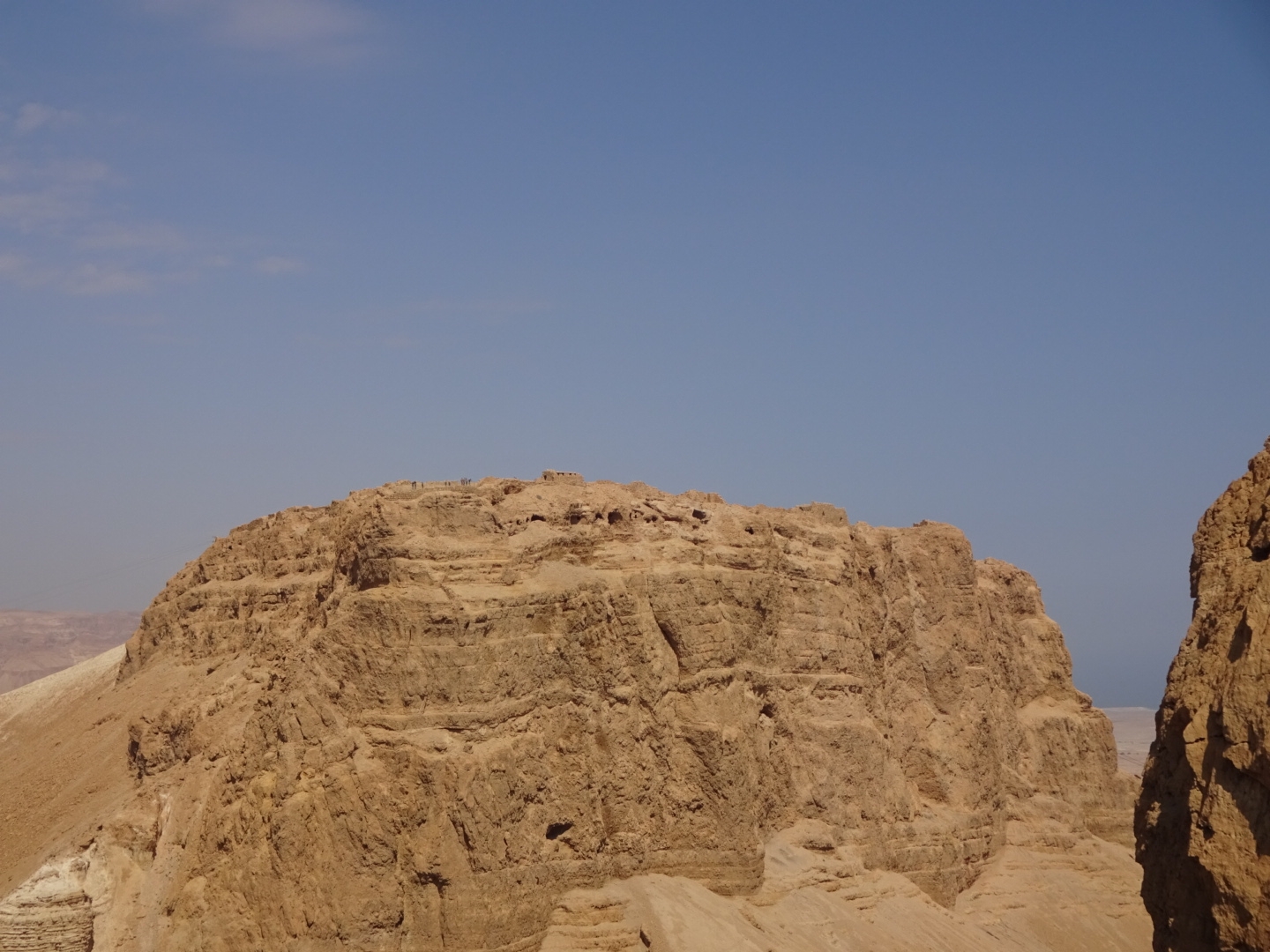
Rough walking followed over ground near the road (walking on the roadside would have been easier), then the path climbs steeply up towards Masada. As I crossed hills and valleys I began to wonder where the famous ruins were as my GPS showed them getting progressively closer. Then reaching the top of a hill (Mount El'azar) there it was in front of me. On the other side of a deep valley Mount Masada was surrounded by tall cliffs and topped by some inconspicuous masonry ruins, plus some tourists, small in the distance leaning over the railings.

Mount Masada, clearly an easy place to defend until the Romans built a siege ramp (on the left of this picture)

Ruins on Mount Masada

I slithered down loose gravel and stones, then followed a path around to where the Romans had built a long, earthwork ramp to reach the top of the cliff, end the siege of the fortress and defeat the Jews once and for all.
Nearby there was the National Park office and some way further on, the campsite. No-one was at the campsite, on returning to the office I was told it would open at 4:00 pm. Thankfully, the helpful man in the office let me leave my rucksack there so I could explore the famous Masada ruins. Fortified by a Magnum Ice Cream and Coke I followed the Romans' siege works up to the Byzantine gate of the complex. For the next few hours I walked around the plateau instructed by the leaflet provided with the entrance ticket. Without the leaflet and helpful signs describing what you were looking at and its history, it would be just a collection of stone walls, with extensive views over the Dead Sea and surrounding mountains. As it was I knew I was at the remains of Herod's palace, the bathhouse or, somewhat unexpectedly, his swimming pool. Huge cisterns and extensive storerooms would have held enough food and water to enjoy a hedonistic lifestyle in the desert or withstand a long siege. Later Jewish remains attest to its place as the rebels last stand. They left a synagogue, within which a room has been built in which a rabbi was writing out some text in beautiful calligraphy. After the Romans left a community of Christian monks occupied the site leaving the remains of a Byzantine church. The walls of buildings at Masada have been partially reconstructed and around them, numerous tour groups of many nationalities perambulated. They usually had some device to distinguish who was in their group, I thought the lime green neckerchiefs of one party were particularly stylish. 
So far I am the only person in the large campsite, illuminated by many bright lights. Unexpected as the guide for this section warned it might be full and be sure to book. Still I cannot complain, the toilets and showers are immaculately clean, the water does eventually run hot and there are picnic tables and sinks. The man from the office also showed me how to switch the campsite lights off when I was ready to sleep.
17 kilometres walked today to the campsite, excluding my walked up to the Masada ruins.

Saturday, February 22, 2020

Rest day in Ein Bokek: Day 20

Not doing much today just resting and eating a large amount at the hotel buffets.
As well as getting physically tired as a result of 18 days of walking, I felt I was getting mentally tired. No longing bothering with side visits to summits or forts, just wanting to reach my destination. Not concentrating on where I was placing each step, and as a result getting clumsy, slipping a bit on an angled rock or loose gravel, hitting the ground too hard. So it's a mental as well as physical rest today.
Not that there is that much to do on the Sabbath in Ein Bokek after you have floated in the Dead Sea and had a coffee, cake and ice cream. Many shops are closed. Still it's a chance to update my blog and finish the book I have been reading. 

Friday, February 21, 2020

Amiaz Night Camp to Ein Bokek on Israel National Trail: Day 19

Up and down wadis today leading to my arrival at the Dead Sea, lowest point on earth.
Last night, at 3:00 a.m. in the morning I was woken by the sound of cars pulling into the campsite and people moving around erecting tents. A little late to arrive, I suppose being the start of the weekend they had travelled a long way after work to get here.
Nahal Pratsim, down which I hiked first thing, began as a small, narrow canyon between walls of soft sediment. The layers of sediment were deposited in a lake as thin, flat, parallel layers. Periodically, maybe due to an earthquake, some of the sediment slumped down the slope into deeper parts of the lake. Such events have been preserved as contorted lines, artistically displayed in the morning sunlight. The wadi gradually opened out ending in a plain. 

Slump structures (about a metre in thickness) preserved in the sediments on the walls of Wadi Pratsim

Narrow part of the canyon

In the distance was a "Dalek" petrol station with a convenience store offering coffee and croissants. I diverted down the road to reach it eagerly anticipating a late second breakfast. Sadly, although lights were on in the shop, it was firmly closed, despite a man beating on the door. They were certainly missing a lot of custom as many people were out for the weekend, parked at the petrol station unloading bikes and nursing babies, casting eyes at the closed shop. There were no times written on the door, maybe it would open later, who knows? If there had been no petrol station I would have been happy, but having hoped, indeed expected, a morning coffee, I was unreasonably depressed at not getting one.
I walked up the next wadi between its high sides, disturbing a group with a guide who was giving a talk by a dry waterfall. Despite my attempts to be quiet and not disturb his lecture, the loose pebbles made loud crunching noises as I walked around the people searching for the next waymark, essential to find how to overcome the wall of rock in front of me. Climbing further I encountered several smaller groups enjoying a sunny weekend. Then it was down the next narrow canyon. The guidebook warned I might need to use my utility rope to lower my large rucksack down some difficult bits. What utility rope you might ask? I had not packed such luxuries in an unsuccessful effort to get my rucksack weight below ten kilograms (excluding food and water). Fortunately I managed to squeeze by the rocks and boulders with my big bag on my back, maybe not in an elegant fashion, but it's the outcome that counts.

The Dead Sea

Note the elevation reading on the right on my GPS, not something you will see elsewhere

At the end of the wadi, beyond a road and a line of palm trees, there was the Dead Sea. Beyond a beach of sorts, there was an expanse of white, crystalline salt before open water. It crunched as I walked on it, the coarse crystals catching the sun. My GPS read an elevation of minus 380. 380 metres below sea level (surprisingly close to the guidebook's value of minus 385 metres).
In the distance the hotels of Ein Bokek shone white in the sun competing with the white lumps of salt in the water. On arriving at the town it was apparent that most of Ein Bokek consists of hotels, through there are a few shops selling cosmetics and a mall with expensive brand names written on the side. My phone had been refusing to assist in the selection of hotels. I think it had been picking up expensive Jordanian mobile transmissions which had drained the £70 on my mobile and hit the maximum data allowance permitted when roaming. So I chose a hotel (Leonardo's Inn) away from the beach (normally they are less expensive) and booked in for two nights. After walking every day for 18 days I was due for a rest.
However...before resting there was one thing I wanted to try. I put on my swimming trunks (a very tiny pair for weight saving reasons) and went down to the public beach. Yes I can report, you do float very easily in the Dead Sea. What I had not anticipated was that under the water there was a layer of crystalline salt, a bit rough to walk on!
22.6 kilometres walked today, including wasted diversion to closed petrol station.

Beach at Ein Bokek, the layer of salt that surrounds the Dead Sea elsewhere must have been cleared away at this location


Thursday, February 20, 2020

Nahal Tamar to Amiaz Night Camp on Israel National Trail: Day 18

Much of the day was spent walking in an area with an industrial air, views of factories, a conveyor belt, pylons and warnings of industrial pollution.
Last night I slipped into sleep listening to the flapping of the flysheet in the strong breeze, some persistent rain drumming on the tent and the sound of lorries, their engines struggling to pull their loads up the steep gradient of the nearby road. Fortunately, in the morning the tent was still in one piece, I was dry and the wind had dropped. 
The addendum to the guide for the diversion of the Israel National Trail to the Dead Sea, that I downloaded from the internet, implied that today's hike would be mainly downhill. While that was the overall pattern, my GPS registered at total ascent of some 470 metres. These climbs, in and out of wadis, I found more tiring than I should have. Its a psychological effect, if you know you have a big climb or difficult path it is easier than if you have an unexpected one.

Peres pirs

Looking back

The first part of the day was best, a visit to the Peres Pits, a canyon with pools of water, a viewpoint across the evaporation ponds at the lower end of the Dead Sea (rendered less visible by the haze) and a path down a long descent. Then it was across what looked like a wasteland on the plain to the west of the Dead Sea. From the dirt track the factories of the Dead Sea works were visible on the shoreline and later the route went under an extremely long conveyor belt carrying potash from the factories, across the plain, up a high cliff and out of sight. Signs warned against hiking in Wadi Ashalim, which was highly polluted by a dam collapsing in 2017, releasing toxic chemicals, many ibex died. I was not entirely sure where the polluted area extended but trusted that I would be safe if I stayed on the Israel National Trail. Another reason for sticking with the trail was a possible minefield. As I approached Amiaz Night Camp there was another industrial structure to end the day's sights.

Factories on the shore of the Dead Sea and a very long conveyor belt

Minefield by the track

Amiaz Night Camp with my tent

I deliberated between Amiaz and Amiaz West Night Camps which are a kilometre apart. The latter had better scenery, acacias and birds but the ground was stony, full of boulders, and the wadi it was in could be prone to flooding. Amiaz camp lacks much in its immediate surroundings, it sits on a flat plateau, but it has well groomed sites for tents, spread with gravel. There was also a distant view of Mount Sodom, apparently a salt diaper, illuminated with patterns of slow moving sunlight created by gaps in the dark clouds as they crossed the sky.
Having collected my cache of water I had plenty to spare, so, feeling sticky with accumulated sweat, I decided to strip off in the empty camp site and poor a litre of water over myself in an impromptu shower. There was no one around until I was suitably wet and then two 4x4's drove by on the nearby dirt track. I struggled to cover up quickly. Hopefully their eyes were focused on the road and not on me.
I dined at 6:00 pm, sitting on the low stone wall beside my tent, just after the sun set - tuna, dried apricots, biscuits (with a picture of a cake on the wrapper) and an apple. Beneath me shimmered the orange and white lights of factories and villages beside the Dead Sea, higher up there was a more distant city of lights that seemed to float in the sky, presumably somewhere in the mountains of Jordan. Above them all, the lights of an aeroplane pulsed as it flew by starry constellations in the heavens. 
20 kilometres walked today.

Wednesday, February 19, 2020

Makhtesh Katan Night Camp to Nahal Tamar on Israel National Trail: Day 17

Highlights today were crossing the Small, but perfectly formed, Crater, and the trail down Nahal Tzafit.
A short walk took me from my campsite to the edge of Small Crater (Makhtesh Katan). Unlike the other "craters" I have walked by (Ramon and Large Crater), this one actually looks the part, circular with high cliffs on every side except for a small notch where the water escapes. Despite several attempts at photographing it I was dissatisfied with the results, the width of the panorama and the overcast, dull and windy weather made it difficult to capture the majesty of the area.

My attempt at a panoramic shot of "Small Crater" in rather poor weather conditions

The path dropped away steeply down the side of the crater, with rungs and railings to help me down tricky parts. Once on the crater floor it was easy and fast walking towards the "notch" in the cliffs, at which point the trail takes a right angle turn. After some unexpectedly difficult wadis to climb in and out of, the path started rising. While there was no scrambling over rocks and rungs, returning to the top of the crater wall was a long and tiring trek. Nevertheless by midday I reached the junction where the Israel National Trail has been diverted towards the Dead Sea. 
A decision was needed, either to continue to Mezad Tamar Night Camp, two kilometres away, where I had intended to camp, where water was cached for me and where there were Roman remains, or to head down Nahal Tzafit on the new route of the Trail, and camp by Route 25,  which would cut a day out of my itinerary. Attempting Nahal Tzafit is not recommended if there is a flood warning in force. There had been a yellow warning last night on the Israeli Meteorological Service website, but that ended 7:00 am this morning. Yellow warnings advise there may possibly be a problem and seem quite frequent, to date resulting in only a few drops of rain. I tried to check the latest forecast but my phone declared there was "No Service", even last night I was only picking up Jordanian mobile signals, which meant I went through a lot of money very quickly. The sky was now mainly blue, the earlier clouds having been blown away, so I decided on the Nahal Tzafit alternative. My only regret was not having a chance to say goodbye to the Danish couple who were somewhere behind me and planning to hitchhike to Tel Aviv from Mezad Tamar.
My descent of Nahal Tzafit had its exciting moments. In two places, the path traversed narrow ledges above significant drops as if worked its way around some large, dry waterfalls. Metal rungs (actually bent rebar) helped in key places. At one point the trail pushed through a tunnel of vegetation, half way up a cliff, to escape a ledge rapidly diminishing in width and gain a higher ledge. Such vegetation on cliff sides is rare. Having committed myself the blue sky disappeared and a few raindrops fell but I reached Route 25 at about 3:00 pm without mishap. 
In search of a coffee and additional water supplies, I decided on a visit to a petrol station four kilometres down the road. These four kilometres involved a descent of some 300 metres so I risked a serious climb on returning to the trail. The kindness of Israeli drivers saved me the effort, I managed to hitch a lift down to the petrol station and another back again without too much effort. The coffee and croissant was most welcome. On my return trip I was even given some fruit and halva (a sort of Arabic sweet), which the passenger in the front seat had been given for lunch but did not want.
I selected a suitable flat area on the trail, used by previous campers, a little way from the road and a series of metal signs describing the geological evolution of the area (in Hebrew only). High winds violently shook the fly sheet as I first pegged one end of the tent down before inserting the poles, in order to prevent it all blowing away. Last night the wind buffeted the tent and it looked like tonight would be similar. I have a lightweight tent (a Terra Nova Laser Competition) and this is going to be its last trip as a few days ago the zip to the inner tent stopped staying together. Sunlight weakens the thin fabric. Even when it was new a few years ago an instructor in mountain craft doubted its robustness, so I am hoping it survives another night with the low denier nylon fabric flapping manically. Fortunately the pegs are surprisingly sturdy so I can hammer them firmly into the stony ground with a rock without them bending (much), unlike a well bent example left by a previous camper.
24.2 kilometres walked today, excluding my efforts getting a lift to the Petrol Station. 810 metres total ascent.

Tuesday, February 18, 2020

Oron to Makhtesh Katan Night Camp on Israel National Trail: Day 16

The descent of Ma'ale Palmach was the most gripping part of the day, the canyon it lies within was also impressive.
Last night I had tucked myself in my sleeping bag at 8:20 pm, enjoying the sensation of being snuggled up, listening to the sounds of the Oron plant and the lorries coming to and fro. An early night as I was planning to start at sunrise, 6:00 am, also, after eating and reading my Kindle for a while (a book by Amos Oz a famous Israeli author) there was not much else to do. As I prepared to sleep, a man came up to my tent speaking loudly. Fearing I had transgressed some rule I poked my head out, and indicated I was English (I am actually Welsh but outside of Britain it's too fine a distinction). He offered me bread, salad and chicken. Taken aback I explained I had already eaten but agreed to take the bread for tomorrow. There was no charge. He bellowed at bit at the Dane's tent but they were already asleep. When he had gone I felt really sad and bad. He made an effort to come and offer us free food, packaged it in plastic bags, and I had refused most of it. Probably I would have enjoyed it despite having eaten already. I shared the bread (it was a full loaf) with the Danes in the morning. 

Edge of "Large Crater"

My morning began with a climb back up Mount Karbolet to some excellent views over "Large Crater", as it is called. (Like all the craters in the Negev it is the result of erosion, not a meteor impact or a volcano). Returning back down the mountain it was under a railway track through a low drainage tunnel. I also walked through one yesterday. Doing so with a rucksack is a challenge, as it is difficult to bend low enough to avoid the rucksack hitting the roof. Carrying the weight of your rucksack in front of you is also arduous. 
Crossing a road I began looking for the Ein Yorkean oasis with its Roman steps referred to in the guide. I found some muddy pools and nearby a canyon with pools of grey water which may have been it. As I looked around two coaches of what I took to be school children arrived. Not wanting to get caught up in some melee with them, I headed down the canyon to where there is a large dry waterfall, apparently the highest in Israel. To get around it the trail follows a rather precarious ledge above a significant drop, there are a few metal bars attached to the rock to help you avoid falling off. After the ledge and an easier path down I reached the Ma'ale Palmach, where a special paramilitary unit made a daring ascent up the cliff face in the 1948 War. Fortunately, today there is a ladder, which I used to reach the canyon floor.

The ledge that the Israel National Trail follows

Large dry waterfall

View down the canyon

A large, attractive canyon with acacia trees, under one of which I rested, watching the birds watching me. A creature like a big, brown marmot shot across the path. Then, inevitably, there was a steep climb out of the canyon followed by a more gradual ascent between rounded hills. On one such hill stood the ruins of a Roman fortification. 
Eventually I reached Makhtesh Katan Night Camp (the Danish couple got there first and were sunbathing). According to the internet there was a water source at the nearby military installation (which seemed to consist mainly of aerials). A sign at the campsite pointed in the wrong direction, not leading to anything, so I approached the entrance of the military enclosure where I spotted a square tank a little way up a road through the outer fence. The pipework and tap was at an odd angle and there was no sign but it seemed to deliver water with which I refilled my "platypus" bags.
As darkness falls the wind is picking up with possible rain forecast.
22 kilometres walked today including fetching water according to my GPS, which was struggling with signal in the deeper parts of the canyon.


Monday, February 17, 2020

Mador Night Camp to Oron on the Israel National Trail: Day 15

A tiring day climbing up and down the numerous peaks of Mount Karbolet, with great scenery looking down the ridge and over "Large Crater".
As recommended by the guide I started early. After a few kilometres on the flat, the exciting bit began, climbing up the steep valley of Nahal Afron. Unusually, today I was not alone. Periodically I caught up with the Danish couple I met at last night's camp, passed them, or they caught up with me. As I pulled myself over blocks of rock with the aid of the metal rungs cemented into the rock (securely I hoped), or skirted water filled pits, it was good to know someone was around if things went wrong, and also someone to discuss the best route around a pool of water. Finally reaching the top it was up and down several peaks. On one summit we met a group of students from Be'er Sheva out for a day. From where we met them, the line of Mount Karbolet stretched into the distance. The mountain was a tilted slab of rock, near vertical on one side and sloping on the other. Walking along the sloping limestone put a strain on the ankles, and attention to where I placed my feet on the uneven surface distracted me from the impressive vista around me.

View down Mount Karbolet

Inquisitive Ibex

Finally, a few kilometres more than the guide suggested, the trail led me down down a valley into the plain and the Oron plant. This is a phosphate quarry and processing facility. After a giant sculpture of men with their arms in the air and an avenue of palm trees, beside the main entrance, there was a picnic area with some taps for water. Not a pretty spot to camp, surrounded by conveyor belts, mounds of rock, and a road along which lorries came empty and left full. Still, there was water for washing (the Danish couple even washed their hair) which added a bit of luxury, and a man selling ice cream and cokes came by....
19.9 kilometres walked today and 1000 metre climb according to my GPS, which was a bit "jumpy" today.

Giant sculptures at the entrance to the Oron plant

Oron plant at sunset


Sunday, February 16, 2020

Midreshet Ben Gurion to Mador Night Camp on Israel National Trail: Day 14

A short day before the climb of Mount Karbolet tomorrow.
For the next 6 days (plus or minus) there will be no opportunity to buy food, so I made an important visit to the small supermarket in Midreshet Ben Gurion this morning. As I do not carry a stove for weight and logistics reasons (you have to buy gas canisters "in country", you cannot take them on a plane) the food had to be edible cold. After much deliberation I bought tuna, sardines, biscuits, nuts, dried fruit, some soft tortillas in sealed plastic, peanut butter, M&Ms and a collection of cereal bars. I hoped it would be enough, it was probably too much, it certainly weighed a lot and cost plenty.
I walked out of town via Ben Gurion's tomb and park. The park was tastefully landscaped, a path through a little "valley" constructed of blocks of local rock was surrounded by watered lawns, trees and desert plants. Located on the cliff edge, the desert behind them, the graves of Ben Gurion and his wife were simple blocks of stone inscribed with their names in a dramatic setting.

Ben Gurion's park

Continuing along the promenade I came across a group celebrating communion, the priest blessing the bread and wine, the golden chalice glinting in the morning sun, the desert panorama behind him, a moving sight. Possibly a church group on a tour of the Holy Land, a coach stood nearby.
Descending the "Zin ascent", which I laboured up yesterday, a Park Ranger in a pickup stopped by me. Concerned there may be heavy rain, which could cause flooding of the canyon I planned to climb the following day, he noted my phone number and said he would tell the relevant ranger that I would be at Mador Night Camp tonight, in case I needed rescuing. 
Today's walk was uneventful, mostly flat with a few ups and downs across small valleys and with rare, attractive, patches of flowers, large cliffs to my left. At one place people had arranged stones into Hebrew words or names or patterns. 
I was not to be alone at Mador Night Camp, a Danish couple had already pitched their tent and like me were planning to climb Mount Karbolet tomorrow,  which is supposed to be the most difficult day on the Israel National Trail.....
20.4 kilometres walked today.

Saturday, February 15, 2020

Hava Night Camp to Midreshet Ben Gurion on Israel National Trail: Day 13

Several sights today, an oasis, a pool with people in it and a dramatic descent, before being offered coffee while searching for my accommodation.
I was on the trail early at 6:30 am, but not as early as a German hiker who I met on leaving camp, he had already covered a few kilometres. After a period of easy walking on a pipeline track, the path, lined with flowers, turned off down into a wadi, attractive with its white rock walls. A profusion of date palms advertised an oasis ahead. While there was lots of vegetation and a trickle of water in the middle I saw no sign of a palm fringed pool that one imagined at an oasis, maybe I missed it as the route soon took me up the mountainside out of the valley. After much climbing the trail dropped into a second wadi. As I descended, the path kept to rock ledges at the sides, the centre being full of rushes and other vegetation. At the edge of the reeds I spotted my first flowing trickle of water of my two weeks of walking through the Negev. This led to a few pools, full of green algae and a little later to a "waterfall", very little water was flowing over it but below there were a few pools. Beside these pools, people were either enjoying the sun, the men showing their naked chests, or else taking a dip in the water. The water had a downside in that it made the path down slippery, and despite my efforts I ended up on my bottom, making my trousers mucky much to my disgust.

Pool in Lower Ein Akev

Purple flowers growing in the desert

Leaving the wadi behind I made the long ascent up Hod Akev passing areas rich in purple flowers. The climb was in two parts with a flat bit between, not so bad. The descent was quite different and quite unexpected. No reference was made in the guide as to its difficulty. The first rungs into mid air over the cliff edge were not so bad but then I took the wrong route down. Realising I had lost the waymarks I was in a quandary, either I could make my way down the scree, or I could make the difficult climb back up to the last waymark. I wisely did the later, wisely as another cliff was hidden below the scree that I would not have been able to climb down. I discovered the correct route hidden behind a rock. It was not an easy way down but iron rungs in places helped plus some "no hikers" signs where one might be tempted to take the wrong route. 
With the Akev night camp in sight I turned up to a pipeline route that took me up the long "Zin ascent". A few other parties were sweating up the same ramp to their cars parked at the top. No car for me so it was another 30 minutes walk to reach Midreshet Ben Gurion. 
Next challenge was to find the accommodation I had booked for the night. I walked to the correct coordinates (inevitably on the other side of town), but there was nothing in the way of signs to tell me which of the pleasant residential houses I might have booked. Ringing its phone number just resulted in a recorded message (in Hebrew). No-one seemed to be around to ask until a couple returned from a cycle trip. Quickly I walked over and asked where my accommodation might be. They did not recognize the name but kindly offered me coffee while they rang around their neighbours. Coffee was very good, my host taking the time to warm the glasses beforehand, and cookies too! My accommodation was nearby and soon I was showering. 
In the evening I went to the Zuma pub for a burger and beer plus some good music, less well known Pink Floyd, Amy Winehouse among others. 
29.5 kilometres walked today, including the extra to reach my accommodation and healthy 920 metre total ascent.

Friday, February 14, 2020

Mitzpe Ramon to Hava Night Camp on Israel National Trail: Day 12

Nahal Hava was the major event of today, the climb into, down and out of this canyon system, late in the day, was, as another hiker put it, challenging.
For me, it was a late start, leaving Mitzpe Ramon at 9:15 am after enjoying a good breakfast and stopping to buy some batteries (and I could not resist a chocolate croissant). Most of the day was along a vehicle track, flat or gently undulating, broadly following the cliffs that form the northern side of the Ramon Crater. First sight of interest was a sculpture park, with various large installations, mainly made of stone blocks. Not quite the standard of Gormley's "Angel of the North" I thought. 
Although it was not normally possible to see over the cliff from the track, at some places it was closer and there was a look out point where I admired the distant ranges of mountains, looking grey today rather than brown or red, due to the haze. At another point, the ruins of one of the forts (Mezad Mahmal) stood on top of the cliff, built to protect caravans on the Spice route, although only a few walls were left of it. Patches of flowers, violet and yellow provided cheerful pools of colour beside the track.

Cliffs on north side of Ramon crater

Remains of Mezad Mahmal

Possibly because it was the weekend, a lot of people were out for the day; walking, on mountain bikes, in a 4x4 or on motorbikes. Those walking often stopped to ask where I was headed and where was I from.
After some 18 kilometres the trail headed north, away from the cliffs, climbing a ridge. Then came the day's high point, Nahal Hava. The trail plunged down into a narrow canyon, steel rungs helping my descent. A short way down the narrow canyon it joined a larger one, passing under a dry waterfall where there was a pit of very green water. Unseen birds exchanged whistles with each other. 

The route down into Hava canyon

Entrance to Hava canyon

Progress down the large canyon proved difficult, involving climbing over large blocks of rock that had at some point fallen off the cliffs each side. My big rucksack made it awkward to squeeze around large boulders. I was beginning to be concerned that I might not exit the canyon before dark. Hurrying was not an option, I would just risk injury at a location where I was unlikely to get a phone signal. The people I had seen earlier had all disappeared, no doubt heading for home or wherever they were staying. I could have pitched my tent for the night in the canyon against the rules of the Nature Reserve, but the risk of falling rocks would have weighed heavily on my mind.
Slowly I made my way down one canyon and turned up another until I reached the place where the trail climbed the canyon side. With the help of some metal rungs at one strategic point, I gained height quickly. The trail then followed the edge of the canyon to its top and just as the light was fading, a further climb took me to Hava Night Camp, located on top of a hill. Yanir's water cache was a good walk away but on returning the sky was a gorgeous mixture of reds and blues.


Eating my tea on some rocks in the dark I was joined by small mouse with big, black, shiny eyes who was trying to finish my tin of salmon. Park rules say not to feed the animals so tonight he was out of luck.
28.6 kilometres walked today including diversions to see sculptures and forts.