Wednesday, March 25, 2020

Israel National Trail: General remarks

The pages of this blogs cover the 1000 kilometres of the Israel National Trail (Shivil Israel) that I walked before the Coronavirus pandemic forced me to return home, without finishing the last 100 kilometres of the trail. I began on the 3rd of February walking from Eilat in the south and finished 45 days later, including side trips to Jerusalem, Bethlehem and Nazareth.

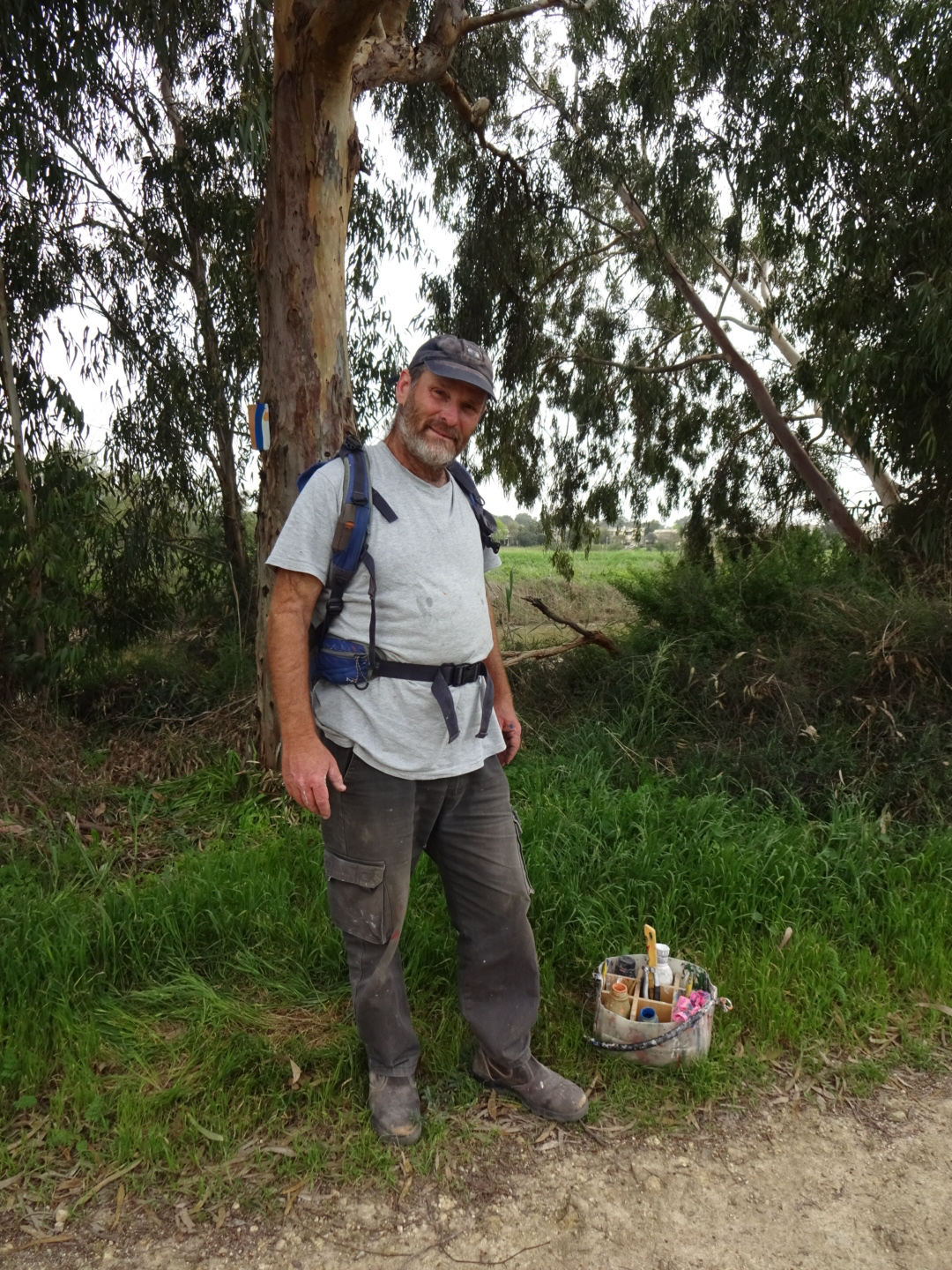
The Israel National Trail falls into two quite different parts. The desert section of the trail to the south is full of dramatic landscapes and some exciting, if scary, bits for a hiker. Hiking north of the desert in springtime, the countryside was full of flowers, forests, and there were plenty of historic and cultural sites.

I used the Red Guide as my primary reference for the trip, plus a GPS track (which I split into sections small enough for my GPS, i.e. less than 10,000 points) and the Garmin map of Israel downloaded onto my GPS. For the route I actually walked see wikiloc.com or Viewranger. Details of updates to the trail and other information can be found on tapatalk, shvil.fandom.com and israeltrail.net. Some people have criticised the Red Guide but I found the detailed maps and the explanation of the sites I was passing particularly useful, it's just a pile of stones unless you know it was once a crusader fortress. One should be careful about over-reliance on a GPS track as in some cases I lost satellite signal despite a good view of the sky, and in other cases I was in a desert canyon, where lack of a clear view of the sky meant GPS positions were not reliable. Having said this I felt the distances given in the guidebook were often a kilometre or so less than they should have been, even if my GPS was wrong in this (and my feet suggested not), you need to add on extra kilometres to visit grocery stores, water supplies and accommodation. On occasions, short distances on the map, were actually long distances due to the path meandering back and fore. In general the guidebook's recommendation for the daily stages were good, especially if you are planning for many days of hiking. Although I managed to reduce the number of days walking slightly, by covering three days in two, I made up for this by "rest" days in Ein Bokek, Jerusalem and Nazareth, with the latter two well worth staying a day or so.

A few general comments; in February and March when I travelled, good weather could not be relied upon, if you plan to walk the trail you should be suitably prepared. In these months I found my down jacket essential in the desert to keep warm in the evenings and mornings, and later on in my trip, I wished I had brought more gear appropriate to wet and muddy conditions. I am sure the experience would be different in later months. Israel is more expensive than most European countries, although the amount of camping necessary in the desert and the possible use of trail angels later on can keep costs down. For British hikers, consider changing to the "3 network" for your phone, in Israel it charges texts and data at European rates, considerably cheaper than other networks. Watch out however by the Dead Sea when you can pick up Jordanian mobile signals and much higher costs.

For more details see the links to different parts of my blog below:

Start of my blog;
Comments on the desert section;
Comments on Central and Northern parts of the trail.

The Israel National Trail has been described as one of the world's 20 best hikes and most epic trails by National Geographic, and it deserves this accolade due to its mixture of dramatic desert landscape, wild flowers, historical and religious sites. Even better the people were really welcoming and friendly to this stranger in their land.

Israel National Trail waymark


Israel National Trail Central and Northern Sections: Some Comments

North of the town of Arad the Israel National Trail passes through a number of landscapes. The forests were perhaps most surprising, mainly of pine in the mountains, deciduous trees lower down, they extended across hills and valleys, including a green corridor that extended as far as the outskirts of Jerusalem. Most were planted since 1948 with many signs recognising the donations from individuals and families that made them possible. Despite their beauty, with carpets of flowers spread beneath them at times, it was sad to think they sometimes replaced old Arab villages and pastureland, occupied before 1948. Outside the forests there were areas of rough grazing and low trees and bushes, often with grazing cattle and maybe some Bedouin shepherd or shepherdess with their flock of sheep. On occasions the trail followed a stream bed or river for several kilometres as it meandered across the countryside, lined with trees. At other times I walked among fields of young, lush green crops, by vineyards and orchards, almond trees with blossoms dropping petals like confetti at a wedding.
As I walked the trail in March the red anemones (called kalanit) in open grassland, the cyclamens in woodland and among rocks, the iris of colours I had not previously seen and many other flowers brightened my trip. Later in the year I would expect everything to be as dry as straw, but in spring it looked lovely. It was not all easy walking, there were hills to climb, rocks to cross, in places aided by a few metal rungs and a cliff to climb down in the rain. The weather was wetter than I had prepared for, with a considerable amount of mud (to save weight in the desert I had no gaiters to protect my trousers, no waterproof trousers and no trekking pole to help my balance on slippery surfaces). Rain could be extremely heavy, with thunder and lightening forcing me to find shelter. Owing to the rainfall, streams had turned into rivers and there were river crossings I had not expected.
Along the coast the landscape was quite different, For three days I walked on or close to the Mediterranean sea, on the beach, on promenades and pavements, and in dunes. This was the most urban part of the walk passing by Tel Aviv, Netanya and Hedera, although some sections of coast were surprisingly free of urban sprawl. In general the trail is routed to avoid towns and villages, so it felt like the middle of the countryside, even if a major settlement was nearby. The settlements I encountered were variable, there were villages and kibbutz, surrounded by high fences with barriers to prevent entry of unauthorised vehicles, all the buildings were located inside the fence so that the boundary between the urban area and the countryside devoid of buildings was very sharp. At the other extreme there were Arab villages and towns, generally poorer, with more hazy edges, no fences and maybe some loose dogs. Previous bloggers had implied that outside the desert section it was all walking on farm or forest tracks. While there are some, there are also lengthy distances on footpaths. On occasions I wished for less paths and more easy walking on vehicle tracks!

With big archaeological sites like Caesarea and Apollonia, and many small ones on the route, and with side trips to Jerusalem, Bethlehem and Nazareth there was a lot of history and culture on this part of the hike. Most days had one or more ancient sites on route. These ranged from bronze age or earlier, through Romans times, to the Crusader fortresses, to monuments to more recent Israeli history, such as the "Burma road" to Jerusalem. Many places had biblical links such as the Sea of Galilee and River Jordan. There were also plenty of opportunities to speak to people, even for a reserved person like myself. In general I found Israelis very generous, hospitable and friendly. If I had wanted I could have stayed with "Trail Angels" almost every night on this part of the trip, which would increase the opportunity to meet more people, I chose not to as I do not like to impose on people's kindness, and am well able to afford a few hotels or camp if none is available. I quite like my solitude.

Waymarking was variable, sometimes good, and sometimes apparently absent (or else I was on the wrong trail), so it was very helpful to have a track on my GPS that I could refer to. On finishing my walk I recorded the route I actually walked on wikiloc.com, here and here, and also on Viewranger shortcodes johnpon0050 and johnonp0051. The Red Guide was also essential as I was loosing satellite reception on occasions, even when I had a clear view of the sky. Not something I have come across in other countries. Nevertheless, in some of the heavy rain, a waterproof GPS was preferable to a soggy guidebook or map. It was also helpful when, lost in thought, I strayed somewhat off the trail and wondered where it had gone. Nevertheless the Red Guide was great for its maps and the background in gave on various heaps of stone and monuments with Hebrew writing.

Agricultural landscape

Coastal landscape

Hill scrub landscape

Forest landscape


Wednesday, March 18, 2020

Migdal to home: Day 45

A sad day as due to advice and measures being taken to limit the spread (and death count) of the Coronavirus I am heading home without having finished the Israel National Trail. A happy day too though, as I will soon be seeing my wife after a separation of over 6 weeks.
First task was getting to Tel Aviv Ben Gurion airport. Thanks to Google I was waiting at the correct place at the right time for an empty bus which took me from the village of Migdal to the larger town of Tiberias. Fortunately I had a bus card that I acquired in Jerusalem as cash is no longer accepted on buses to minimise Coronavirus transmission, the first few seats were also taped off to protect the driver.
At Tiberias I added money to my bus card so I had enough to pay for the next leg to Tel Aviv. As I wandered back to where the bus was due to leave in 20 minutes the driver of a group taxi (a minibus picking up several passengers) told me buses to Tel Aviv were cancelled. Although a nearby official seemed to confirm this I had some doubts. He was leaving immediately. As the price he quoted was not excessive, and as he might have been telling the truth, I went with him. He tried hard to pick up other passengers at bus stops en route but without success. As I was the only one in the taxi as he approached Tel Aviv, between long phone calls he offered to take me to the airport for a larger but still reasonable amount. So I ended up at Terminal 1 Ben Gurion airport at 9:30 am, however, all international flights had now been consolidated in Terminal 3. A shuttle bus took me there a short time later.
Last night I had booked an Easyjet flight on my smart phone for this evening to make sure I had a plane, I now changed it to an afternoon flight. Still left me plenty of time to finish reading my book (Jeffrey Archer's prison diaries,  an excellent read recommended by my cousin)! Despite pictures on the news of empty planes, mine was three quarters full. Only peculiarity was the person opposite me in a paper coverall complete with hood, face mask, large plastic safety glasses and transparent, plastic gloves. He was either trying to avoid catching the Coronavirus or already had it and did not want to spread it. One reason the flight had a good number of people was that many other flights had been cancelled. A distressed lady grabbed my arm as we left the plane and showed me a Wizz air boarding pass to Budapest. Wizz air had stopped flying from Israel a few days ago and so she had been redirected via Luton where Wizz air was still flying. Luton I discovered is not designed for international transfers or passengers whose English is mainly their relative on the phone. Having established from a helpful man on the baggage desk that no bags would have been checked through direct to Budapest she had to fret a while waiting for her baggage to come through. I then took her through to the Wizz air check in desk to drop off her hold luggage and onto security. My good Samaritan bit must have been noticed in heaven as I somehow managed to catch an earlier train to Cardiff that "The Trainline", thought I would miss. Home just after midnight.

Tuesday, March 17, 2020

Kinneret to Migdal on Israel National Trail: Day 44

Very much a day of two halves; a dry, easy morning and a wet, windy, cold and "challenging" afternoon.
My room rate included a boxed breakfast. One of the problems with booking.com is that sometimes when you book a room that can sleep two people you end up with two breakfasts, as I did today, and they were two large breakfasts. I ate four croissants, two pots of yogurt and most of a large carton of orange juice and packed the rest of the food for my dinner tonight.
Kinneret is a village established in 1908 by pioneering Zionists. The buildings of black basalt were made to last, a statement of permanence. Leaving the village I climbed up the side of the ridge that encloses the Sea of Galilee. The path then followed the upper part of the hillside for several kilometres looking down on Galilee.

Sea of Galilee

I walked among yellow wild flowers passing cherry (?) orchards and crossing the Swiss Forest Nature Reserve, only part of which seemed to have any trees. Tiberias with its white buildings spreading up from the shoreline appeared around a corner of the hill and grew steadily larger. The trail crossed the upper part of the town.

Tiberias beside the Sea of Galilee

After dropping down into a valley the path climbs again initially through vegetation, made green and lush by recent rainfall. Caterpillars in large numbers were eating it. The path joined a vehicle track and steadily climbed up Mount Arbel. 
The day began with blue skies but as the morning progressed black clouds gathered above the steel grey surface of the Sea of Galilee. Now heavy rain began, driven into me by a strong wind (my thoughts here turned to the bible story of Jesus on the lake with his disciples when a storm blew up). My GPS was having problems with satellite reception, despite the clear view of the sky, it has been an issue here in Israel. Not wanting to soak my guidebook by consulting its maps, I was relying on spotting the waymarks to find where to go. Fortunately the waymarks were good unlike my vision, which was hindered by a flapping anorak hood and fogged up glasses. I followed a small path around the top of the mountain to a place where it dropped off the side of the cliff. Thankfully the rain eased very slightly, but not very much, as I made my way down the cliff path. On the plus side metal rungs were set into the rock to help you on steep bits, on the negative side the rocks were worn smooth by countless hikers and were now wet and slippery. My boots had a layer of mud on their soles, so their grip was minimal. Each step had to be carefully planned, if possible placing my boot in a ledge or gap where it would be jammed in rather than on a smooth, slippery surface which would have been fine on a dry day. Use of hand holds were essential to maintain balance and manage any slips. A cool head was needed, unfortunately that was not the only thing that was cool. The wind, rain, wet shorts and bare legs were pulling the heat out of me, and the friction between my wet shorts and thighs were pulling my shorts down. While exposed to the rain I dared not put my fleece on, as it would rapidly become soaked. Finally I reached some shelter where I could add some clothing. 
Climbing down the cliff took a while but I eventually gained a path and then the road. I think the route actually went down a valley next to the road but it was guarded by two unfriendly dogs and the stream was swollen by rain so I stayed with the road, its pavement and a border of red and pink geraniums.
As the rain finally eased I crossed some orchards then walked through Migdal to my accommodation for the night. The owner was surprised to see me, claiming there were no tourists. Having pointed out that I had booked online, and I had arrived six weeks ago, well before tourists were prevented from flying to Israel, I was given a chalet, where I enjoyed a well deserved (I thought) hot shower.

Latest News: UK Foreign office has now advised against all world wide travel. It does not actually say come home as soon as possible but that seems to be the drift. Already airlines (Virgin Air, Wizz Air) have stopped flying out of Tel Aviv. BA's website could not offer me any flights. Easyjet is still flying, but maybe not for long. Israeli guidelines are become more stringent, with an Internet report that everyone will be effectively confined to their homes. In the light of this I have felt obliged to head for home tomorrow, despite being so close to the end (6 days and 100 kilometres according to the guidebook).


Monday, March 16, 2020

Kfar Kisch to Kinneret on Israel National Trail: Day 43

A walk across open countryside to the Jordan river and the Sea of Galilee.
I resumed yesterday evening's walk by the tree lined river, between yellow wild flowers and green fields. As warned by my trusty guidebook, I needed to take off my boots to cross a river, however I had not expected another river crossing soon after. My feet are very sensitive so I do not normally attempt a river crossing in bare feet, but for these two crossings, as they were used by vehicles, there was a concrete ramp each side and hopefully under the water. My assumption was incorrect for the first crossing, there were pebbles and rocks under the water which made my balance precarious. The second crossing was easier.
I followed a diversion published on tapatalk up a grassy valley, it worked out well, apart from being stabbed in the head by a thorn as I pushed by a tree trying to avoid mud. I could not stem the blood with my hanky as I had used it to dry my feet, it would not have been hygienic, I had to dig out my toilet paper instead. Fortunately today was warm and sunny and the mud was drying out ever so slightly. I hope I was on the intended diversion, there were no waymarks...

Climb out of Kfar Kisch

Rejoining the original trail, I slowly climbed to the top of the hill, passing a some stones marking where before 1948 there was an Arab village, and (unrelated) a party of hikers with red jackets. I keep two metres away from them to comply with Coronavirus precautions, and avoided saying anything beyond "shalom" so they did not think I was bringing in the infection from some foreign land. One the other side of the hill the trail led to the Elot nature reserve where there should have been a good view, including the Sea of Galilee. I peered through the haze but cannot say that I saw it. 

View of Sea of Galilee from Elot nature reserve

The path then led me down a stream bed, with a layer of volcanic rocks and on through some dense vegetation, fortunately beaten down by earlier hikers. I eventually reached the River Jordan, subject of bible stories and several songs. After some major pumping works I lost the trail in mud, a half completed construction project and a high water level. Working my way around through farm tracks I reached the Yardenit baptismal site, where you can be baptised in the River Jordan, but not today as the site was closed (presumably due to Coronavirus) although I managed to buy an ice cream and coke. On the walls at Yardenit there was a quotation from the bible in every language you could think of, and some like "Fang" you would not think of. Could not find the English version through. The river was lined with eucalyptus trees, which looked pretty, although not something that Jesus would have seen as they were introduced from Australia in the 20th century. 

Yardenit baptismal site

The final section was by some lakes (fish farm?) and up the road to my lodgings for tonight at "Kinneret village". There I spent a while going through 200 odd channels to find Sky news and the latest on the pandemic. Restaurants have been ordered to close in Israel so it is tea from the local supermarket. 

Sunday, March 15, 2020

Nazareth to Kfar Kisch on Israel National Trail: Day 42

A day of two mountains and some slippery mud.
Breakfast was at 8:00 am today rather than 7:00 am as I was told. Maybe because there were so few people staying at the hostel now that tourists are no longer allowed into Israel from other countries due to the Coronavirus outbreak. Abraham hostels have just sent an email saying they have now closed all their hostels due to the pandemic. I am wondering how long I can continue my trip for.
Due to the later breakfast I took a taxi to Mashad to continue on the trail rather than wait for the bus. After a climb up to the Mt Jona settlement I walked beside the road until I reached another iris reserve. The miniature blue ones had died back but there were some impressive white and brown iris.

Unusual wild iris

I walked through a forest for much of the day, mainly pines. Two mountains stood on my route. First there was Mount Devora, on its summit was a concrete memorial to the silver wedding anniversary of Queen Elizabeth and Prince Philip. The "Royal" Forest it stood in was planted by Jewish communities of the United Kingdom. After a fast walk on a single lane tarmac road and through the community of Shibli, there was a considerably slower walk up the second mountain, the shapely Mount Tabor, a mountain standing on its own. Slow, not only because it was a steep ascent, but also as it was muddy and slippery. My boots were already made slick by a layer of mud. For each step I had to look and evaluate where to place my feet to make sure I did not slide backwards and fall. There were plenty of slide marks where others had slipped. Finally I reached somewhere near the top. I then hunted around for the entrance to the monastery and the Church of the Transfiguration, eventually finding it actually on the Israel National Trail. It was closed, although the sign said it would be open, maybe another response to the Coronavirus? As well as the monastery and church, which date from 1924, there were older ruins, no signs on them so I will have to look up what they were.

Mount Tabor

Climbing down was slightly less difficult than climbing up but still had the risk of a slip and a muddy bottom. As the sun cast a more golden light, I followed the riverside path through fields towards Kfar Kisch. The yellow flowers, reeds and eucalyptus trees beside the river made for an enjoyable walk. People in twos and threes passed by me, some of the ladies in hijabs, others not, all out for an evening stroll.

Riverside path to Kfar Kisch

I am now at the Tabor Land Guesthouse learning about the latest Coronavirus developments on the TV. Worrying.

Saturday, March 14, 2020

Nazareth Rest Day: Day 41

The sound of a cock crowing woke me this morning, not what you expect in a big city. It was followed by the Muslim call to pray. Later I heard church bells, not something you hear much of in Israel, but then this is where Jesus grew up.

Lane in old Nazareth

The old city is full of narrow streets arranged higgledy-piggledy. I visited the Roman Catholic Church of the Annunciation then its Greek Orthodox namesake. Both claim to be on the site where the Angel Gabriel told Mary she was soon to give birth to Jesus. The Roman Catholic church is quite new dating from 1969, but built over the foundations of earlier churches and possibly the remains of Mary's home. Its architecture is in what has been called Italian Brutalist style. It has bare and minimally adorned concrete pillars and supports. Large paintings of the Virgin Mary are hung around the walls by different artists representing countries from around the world. They are strikingly different visions of Mary. The Greek Orthodox church, although not large, is much more what you would expect of such a place.

Roman Catholic Church of the Annunciation

Greek Orthodox Church of the Annunciation.

I tried a "freekah" salad for lunch. Freekah is wheat picked when it is greener and soft. Tasted fine although I was mainly tasting the lemon and spring onions they added. In the evening, after another salad (feta cheese, walnuts, apples and other fruits), for dessert I tried Knafeh. Creamy stuff topped with shredded wheat and pistachios, tasted good!

Friday, March 13, 2020

Kfar Hasidim to Nazareth on Israel National Trail: Day 40

Rain, rivers and mud made today a tough challenge.
Periodic gusts of wind shaking my tent meant my sleep was somewhat disturbed. By morning the wind had died down but rain drops were giving the flysheet a real thumping when I woke (although the tent stayed surprisingly dry). After turning over for another 20 minutes, the rain had stopped and I quickly decamped.

Cow pasture in a wooded valley beside the trail.

As I had completed a good distance yesterday, there was a possibility that I could reach Nazareth tonight. Initially this seemed achievable as I covered the first 10 kilometres of cow pasture, bushes and trees at a good pace, reaching Hanezirim Mill. Unfortunately, directly after the old mill I needed to cross a river. There is probably no water in it at all in summer, but last night's rain had turned this little brook into a raging torrent. I removed my boots and socks, and put on my canvas shoes normally used in hotels, made sure everything was in "dry bags" in case I fell over, and stepped slowly into the muddy water. The water came up to the bottom of my shorts as I very carefully made my way across. The river bed was very uneven so care was essential. On occasions such as this trekking poles would be useful to maintain balance (not brought due to weight considerations).

River in flood which I had to cross

Safely reaching the other side I dried my feet with my handkerchief, replaced my boots and socks and continued along the trail, or at least tried to. The river had washed away part of the trail so that there was nothing to walk on between the foaming water and a fence. Consequently I climbed up to a path higher up the side of the valley, sliding on mud and using my hands for support (and generally plastering mud all over me and my rucksack). I continued to the town of Ka'abia. As I approached it, letting a herd of cows pass me (the second of the day), the rain began falling heavily. By the time I was in the town it was torrential, with rivers of water running down the street. I sheltered in someone's car port for a while, then headed down the street hoping for a cafe. A car stopped to offer a lift, but I declined (nobly committed to finishing the trail on foot). As flashes of lightening were quickly followed by the rumble of thunder, and there was no sign of a place for coffee I sheltered again under a shop front. At last the rain eased off, and after making sure all my essential stuff was being kept dry I climbed up a valley out of town and followed the trail over a ridge.
In the next valley I again reached what would normally be a stream but was now swollen into a fast flowing river of uncertain depth. At the point where the trail crossed the force of the water looked too great to contemplate a crossing. Instead I went downstream to where a vehicle track crossed. Then changing into my canvas shoes again I made my second river crossing of the day. Regaining the trail, it climbed through pine woods before making a complicated crossing of a highway interchange. More trees followed until I reached Rabbi Yehuda's tomb in a period when it had stopped raining for a little while (he was an important Rabbi who edited the Mishnah). A man and his son were sitting outside and called me over to join them in a cup of tea. Sweet and green the water was boiled on a small camping stove. It was very welcome after a difficult day, an act of kindness I much appreciated and revived my spirits. Inside the tomb, where it was suggested that repeating a psalm would be appropriate, a man was praying. Stopping briefly, he asked for some money, which I gave him feeling one act of kindness deserves another.
A little time later I climbed into the town of Mashad. I could hear a lot of cars sounding their horns, a wedding I thought, but no, parked cars meant reduced a road to a single lane. Cars were trying to come from both directions creating deadlock. Instead of reversing they were all sounding their horns. A few "one way" streets would help.
Reaching the junction with a major highway just outside Mashad in the rain, I used the bus shelter to avoid wetting my phone and asked Google which bus to catch and when. The number 24 arrived 15 minutes later as it said it would. I managed to use the bus card I had acquired in Jerusalem and was dropped off by the old city of Nazareth some time later. I checked into the Abraham hostel (also called the Fauzi Azar Inn) choosing to have a room of my own, which has a vaulted stone ceiling. It is a 200 years old Ottoman building with a courtyard and lots of character. The call to pray reminds me that I am in an Arab area, the sound of multiple muezzins (all fairly tuneful) giving a Middle Eastern atmosphere that is missing in much of Israel. I have spotted a number of mosques today. Tomorrow I hope to visit churches.

My room in Fauzi Azur hostel, note my sleeping bag drying out over a chair, a useful place to wash the mud off my belongings

Thursday, March 12, 2020

Nahal Me'arot to Kfar Hasidim on Israel National Trail: Day 39

Rock strewn paths made the going slow today as I went up and down mountains among bushes and trees.
Yesterday at dusk and this morning I was under sustained attack by mosquitoes after my blood. This made me pack up very quickly while simultaneously swatting at mosquitoes. A big spodge of (my) blood meant I had killed one after she had done her worst. I was generally put in a poor mood, not helped by the complicated path going over rocks up and down the side of the hill, difficult to follow with all the twists and turns despite frequent waymarks. I was glad the next bit of track was on a vehicle track beside a banana plantation. The bunches of bananas were covered in plastic and the whole plantation was under fine netting, patched up in places where presumably some animal had tried to get in.
Reaching Ein Hod my mood changed from black to golden for two reasons. Firstly the village was populated with a wide range of sculptures, many causing me to stop and admire, intrigued at what the artist had produced and was maybe trying to say. Secondly there was a shop selling cups of coffee (and a banana and chocolate).

Large bronze in Ein Hod

Thus fortified I followed little paths up and down hills covered with bushes and shrubs, over large rocks, beside, between and below limestone outcrops. I passed two parties of school children dressed in blue, being lectured about something. Outdoor hikes seem more part of the school curriculum in Israel than in Britain. 
To reach the town of Isfiya the trail took me up a stream bed over dry waterfalls. There were some rungs and rails cemented into the rock to help you up, needed as the rock was slimy and slippery. It reminded me of the desert section of the trip except here I was surrounded by trees.

Rocky section of trail.

Metal rungs to help on slippery rock

I reached Isfiya at 1:30 pm, too early to stop, so after a hot dog and coke I continued downhill towards the village of Yagur. Although it was a short distance away the path was like a concertina, zigzaging down the hill among the trees, consequently it took me rather longer than expected, not helped by intermittent rain. Once down at Yagur it was fast progress across the valley to Kfar Hasidim. I then continued a little way beyond this village, climbing up through dense bushes until I found a suitably flat piece of cow pasture near the top of a hill to pitch my tent. Only problem, other than avoiding cowpats, is the strong, gusting wind. I pitched my tent pointing into it, but the wind has now changed direction and is hitting me broadside, flexing the tent's single pole back and fore, sometimes violently. Hope the DAC aluminium sections of the pole do not snap...

Wednesday, March 11, 2020

Zakhron Ya'akov to Nahal Me'arot on Israel National Trail: Day 38

A walk through the woods today with no great highlights.
With plans to wild camp for a few nights I visited the supermarket in the centre of town to stock up on tuna, tortillas, peanut butter, oranges and cereal bars. Suitably prepared I returned to the trail which made a lengthy circumnavigation of Zikhron Ya'akov. This included wading through a river (Nahal Daliya) beside a highway. Too deep for my boots I removed them and my socks and crossed in my canvas "hotel" shoes, now rather wet.
Most of today was through woodland, sometimes taller pine trees but usually smaller trees and bushes of various types, densely packed. In the early part of the day the view of quarries and tips was not pretty, it improved later although the vistas down the coastal plain were dominated by trees, fruits and bananas being cultivated under fine, white netting (presumably to keep the birds and insects out) and poly tunnels. The trail repeatedly went up and down the edge of the Mount Carmel range. As there were many crossing tracks and paths, it was easy to miss a waymark indicating a turn. I retraced my steps on one occasion to follow the correct route (a frustrating experience), but next time I simply took a slightly different route. In places I was following forest tracks, with pools of water and deep mud at times, at others the route took pretty paths, although jagged rocks meant progress could be slow. The trail including hiking up a stream bed, fortunately with no water but the low vegetation kept grabbing my rucksack. 

Muddy track with some typical vegetation each side.

The one site mentioned in my guidebook concerned an area inhabited by Arabs before they were displaced by the 1948 war. One intact building remained which looked like a small mosque as there was a mihrab, a small alcove showing the direction of Mecca.

A section of path

A rocky section of path

As evening approached there was a fine display of miniature blue iris. Although the red anemones are now past their best I saw many other attractive flowers.
The geology was mainly limestone, resulting in a number of caves and holes in the ground. I am camped at the entrance to the Me'arot caves where evidence of many years of human occupation was found. Unfortunately, by the time I arrived, after a slow day, the visitor centre and caves were closed.

Tuesday, March 10, 2020

Hadera to Zikhron Ya'akov on Israel National Trail: Day 37

Main event of the day was visiting the extensive, ancient remains at Ceasarea.
Today's walk began by walking over undeveloped land to a Power station. First commissioned in 1981 its workings are not enclosed in walls, instead the girders holding the plant up are visible on the outside. A very different architectural style to the 1930's Power Station north of Tel Aviv (see day 35). A long jetty into the sea allows for unloading the coal required to fuel the boilers. Such coal burning power stations are now considered outdated and detrimental to the environment. With gas discoveries offshore Israel in recent years modern combined cycle power plants using gas are likely to replace the use of imported coal. Indeed it looked like there was a large offshore, gas production in the sea, vaguely visible through the haze from where I walked today. Just before the power station was a park area beside a river, several men with fishing rods were hoping for a catch. The white suspension bridge crossing the river seemed designed with a view to aesthetics as much as function.
After a section of road I reached the Sdot Yam Kibbutz. The trail seemed to be blocked off by a new fence enclosing some house construction. I tried to work my way around the fence but found no clear route, so instead I just walked straight through the village. There were barriers for vehicles, but not for pedestrians. I was checking this evening and there is a recent update to the route on the Tapatalk site, it was issued after I had started my walk. I should have headed east before reaching the kibbutz fence.
The entrance to the remains of ancient Caesarea was directly after Sdot Yam. Conceived and built by King Herod the ruins included an amphitheatre, a chariot racing track, villa and bathhouse. Later a Crusader castle occupied the site. There were a two short films describing the history. Tour groups of numerous nationalities were visiting the large site with me. A South African lady sang their National Anthem in the theatre, demonstrating its acoustics. 
Leaving the main archaeological campus I walked along the beach beside the aqueduct that once supplied the ancient city with water. The beach continued after I lost sight of the aqueduct, a period of slow progress for me as my boots sank into the sand. After passing a little harbour surrounded by fisherman's shacks I walked over some mosaic remains in the dunes and beyond the headland there were some surviving sections of a bridge built in 1898.

Aqueduct at Caesarea

I followed the trail inland to the Arab town of Jisr A-Zarka, where I enjoyed a humus and pita bread lunch, served with tomatoes, onions, olives, finely chopped green chilli and a expresso coffee to finish off.
The next section proved difficult as parts of the trail were flooded, overgrown or blocked by a herd of cows. I worked my way around the obstacles often beside more lengths of Roman aqueduct. The trail runs under a major railway line at a bridge intended for a river. At the same time it also crosses the river. On this occasion the river, swollen with recent rain, was filling the entire space beneath the bridge with fast moving grey water. I decided against removing my trousers and wading through but instead made a three kilometre detour to arrive on the other side of the bridge and river. On the way was an abandoned quarry, the trucks still standing on a rusted railway, waiting to be filled from the  silent, overhead gantries.

Limestone pavement on the cliff edge overlooking the coastal plain

The path climbed a hill to a limestone pavement extending to the edge of a cliff. On top of the hill there were more archaeological remains, mainly of a Byzantine villa, but with older and more recent structures at the same site. In addition there was a pretty good view down the coast.
A little later I reached the Ramat Hanadiv gardens where Baron Edmond de Rothschild and his wife are buried. He was instrumental in helping finance the early Jewish settlers in Israel. The memorial gardens were closed by the time I arrived, and I needed to move smartly to reach my hotel before dark. But on the way I was waylaid by more archaeological remains including a short, small Roman aqueduct that supplied a bathhouse from a spring in a tunnel. Water was still flowing along the aqueduct which was built some 2000 years ago. A little further down the hill there was a grey military looking boat, over 10 metres long, stranded miles away from any water, sitting by the roadside.
Finally reaching the hotel, myself and my passport was carefully scrutinised, page by page, by the serious looking receptionist, I assume to confirm I had not recently been to any countries affected by the recent Coronavirus outbreak. 

Monday, March 9, 2020

Natanya Poleg to Hadera on Israel National Trail: Day 36

Iris, turtles, and a man painting Israel National Trail waymarks were some of the highlights today.
According to my trusty Red Guide the first sight today after leaving Natanya Poleg should be the iris reserve. After a large earth carpark I walked into the reserve. Some men asking after my progress on the Shvil Israel (the Israel National Trail) told me there were hundreds of Iris to be seen, but I was having trouble seeing any. I headed off left towards the centre of the reserve but although there were many other lovely flowers, no iris. Then I spotted one under a white broom (i.e. a broom bush with small white flowers). Having spotted one I was soon seeing them everywhere. They were a dark, deep purple quite different from the usual blue and yellow ones. Some had attracted small snails.

Wild iris

Much of today was along the beach, either on the sand or on concrete paths above it. Through the large town of Netanya, the paths above the beach were in a manicured setting, among carefully tended grass and palm trees. On the beach, the width of sand in places was so thin that I was paddling through water as the small waves washed in. The soft cliffs were unstable, and there were landslips in places, large blocks of rock were sometimes used to protect the base of the cliff from further erosion. 

Promenade by Netanya.

I made a diversion up the cliffs to Independence square in the centre of Netanya for a coffee. French was very much in evidence for some reason and it had a proper French croissant with my coffee (i.e. no sugary stuff on top).
Later on two students sun bathing on the beach asked after my progress on the Shvil Israel and gave me a glass of tea they had just brewed on a small camping stove (very refreshing as the day was hot). I am often asked when I started and why I decided to walk this trail. They were on the beach as it was Purim today, a celebration of Esther saving the Jews, so it was a holiday. The celebration started a few days ago. It can involve dressing up, and I have seen a few frilly frocks in bright colours on men as well as women. 
On reaching a river the trail turns inland following it upstream for a few kilometres. I passed the ruin of an Ottoman customs post and then noticed a man painting an Israel National Trail waymark. He was adding an orange dot to indicate that this was also on the Sharon trail which went inland from this point. I thanked him for his work which makes it a lot easier to find the way. 

The man who paints the waymarks on the Israel National Trail.

At the point where the trail leaves the river, there was a picnic site on the other bank with an ice cream van requiring a visit from myself (also an observation tower). While enjoying my ice cream I was looking at the large catfish in the muddy river, for some reason many had collected at this spot and were circling around. Then a small turtle surfaced, and as I looked closer I saw a much larger one, a metre and a half or so long, which slowly rose to the surface then dived deeper as it swam along. 

Turtle in river.

After crossing some fields, avoiding a flooded section of track, and then walking through a half built industrial estate and some rough ground I reached Hadera woods. I had considered camping here but decided against as it was not so far from built up areas. However, the mature Eucalyptus trees, without too much undergrowth, would have made a good place to pitch a tent. Having already booked a room at the Ramada beachfront hotel, I headed there. I was upgraded to a suite on the 19th floor, from which I watched the round, red sun set below the distant haze covering the sea.
Dinner was at Benny the fisherman, by the beach. I ate too much, I should not have ordered the chocolate souffle for dessert or ate the chocolates left by the hotel in my room.

Sunday, March 8, 2020

Tel Aviv to Natanya Poleg on Israel National Trail: Day 35

A very different day from all previous days: a walk along the coast on the beach, the promenade, through dunes and by an Art installation.

1930's Power Station by Tel Aviv

After yesterday's trudge through mud, starting today by walking along the promenade with the morning joggers was a really pleasant change. A stylish 1930's lighthouse and I thought an equally stylish 1930's power station in white, were the first sights I walked by. There was then a long section with the beach on one side, and an empty area behind barbed wire fencing on the other. Maybe an old airport as there was a lonely control tower. It did mean you had to run over a kilometre if there was a Tsunami warning as the fencing prevented you heading directly inland. Tsunami signs pointed which direction to run in. I had not considered such an event in the Mediterranean before, they usually seem to devastate the Far East, however there are earthquakes in the Mediterranean area so a Tsunami is not so unlikely. 
Looking for where the trail went after the concrete promenade ended I met a German guy also walking the Israel National Trail having started at a similar time to me. We walked together along the beach a little way, sharing experiences. I stopped for a coffee at a Marina. Service was sluggish but it wasn't so bad watching yachts come and go in the sun. Later I joined a 78 year old Israeli who was walking some 20 kilometres for a bit of exercise. He was certainly fit as he sped up the hill to the Sidna Ali mosque (where the call to midday pray was being sung). He came to Israel some 44 years ago, and seemed very glad to have left the Soviet Union. There was a crazy house built into the cliff he showed me. Lots of curves in concrete and mosaics, a bit in the style of Gaudi but not as colourful. 
I left him when I visited the Apollonia archaeological park. There were remains of a Roman villa and some cisterns but the main sights were the remnants of a Crusader castle and town which overlooked the sea. It was destroyed by the Muslim Mamluks after a siege in 1265.

Sea shore before Netanya

I had imagined that it would be very urban along the coast, but beyond the fortress there was a long section of undeveloped open land and well vegetated sand dunes. Cliffs were steep and crumbling so I avoided going too close. Shrubs in bloom lined part of the track and flowers of many colours were spread among the grass. There was an art installation in one place with several large pieces made of wood and wooden cable reels.

Artwork made of cable reels.

City of Netanya beyond the sand dunes.

As the sun began to approach the sea I met my German colleague again. He was planning to camp among the trees whereas I had booked a room in "Q" hotel, which is where I am now. I have showered, washed some clothes and eaten at the hotel buffet. The beach is nearby, it seems an area used by kite surfers, there were several out on the sea as I turned inland to my hotel.

Kite surfers in the evening light at Natanya Poleg.

Saturday, March 7, 2020

Petah Tikva to Tel Aviv on Israel National Trail: Day 34

Rain yesterday evening had made the trail muddy. I slowly, slithered around the interminable meanders of the River Yarkon before reaching a glorious park with tarmac paths.
First I had to return to the trail some 6 kilometres from my hotel. Initially along easy roads, quiet as it was Saturday, people were walking their children in the pleasant areas between the tower blocks. Then the going became difficult as I crossed fields and rejoined the Israel National Trail. An inch of so of mud stuck to the bottom of my boots.

Petah Tikva, tower blocks but some nice areas between them

Sweet singing sounded from a hall at the Baptist village, a centre for the denomination in Israel. After that the trail ran along side the River Yarkon until the end of the day. The river was extremely convoluted, the meanders massively multiplying the distance I had to walk such that following an hour or so of walking I was astonished at the small distance I had moved on the map. There were many places were the mud was deep, coating my boots and trouser bottoms with mud as I tried to find the firmest path through. Slips and slides threatened to end in a full fall, which I narrowly avoided.
Two of the under passes below busy highways were particularly difficult with thick, soft and squishy mud combined with large pools of opaque water of indeterminate depth. I met a large group coming from one. Their leader advised me to risk a crossing of the busy four lane highway, but two of the ladies said quietly that they had managed the underpass. I also managed it by walking on the steeply sloping, but rough concrete that formed one edge of the underpass. The group included a lady from the Geography department of Haifa University who was interested in why people walked the Israel National Trail, today I wondered myself.

Muddy track beside the Yarkon River

In truth, without the mud it would have been a pleasant walk. The river was edged by reeds and bamboo, the latter forming a arch over the trail in places. Eucalyptus trees bordered the river, which was surrounded by fields or citrus orchards. Curiously the oranges were not being picked but left to fall and rot on the ground. I disturbed a heron and spotted a pair of parrots and a small turtle swimming in the river. Some unknown creatures jumped into the water as I approached. 
On reaching an area of parkland my spirits rose, my endurance test in the mud was over as I wandered along tarmac paths. Being the weekend lots of people were out, sitting on the grass, jogging, cycling or travelling on electric scooters, often two people on the same scooter. There were families, dogs on leads, couples canoodling, Dads barbecuing beefburgers, filling the air with smoky, barbecue smells. The park followed the river, often on both sides. There was a boating lake, an outdoor "gym", an impressive arrangement of climbing walls, and a place selling pancake like things, I asked for one with nutella.

Park beside the Yarkon River in the outskirts of Tel Aviv

People were backlit by the sun, low in the sky as I walked towards my accommodation for the night, the Spot Hostel, where I have a small double room. It is indeed small but it has everything required, bed and bathroom. I found something to eat in the nearby port area, no longer a port but a place with restaurants, food stalls (many closing when I arrived) and shops.
Looking forward to an easier day tomorrow.

Friday, March 6, 2020

Gimzo to Petah Tikva on Israel National Trail: Day 33

Rain today, some historical sites and a late change to a 4 star hotel.
A shower (of rain) kept me in my tent a little longer this morning eating a cereal bar or two. On the rain ceasing I packed up and joined an early morning crowd jogging or on bicycles in the Ben Shemen forest. By a road junction a series of stalls were selling orange juice and the flat bread coated with sour cream and tabouleh that I had tried before. So I had a second breakfast prepared by an Arab lady on her stove.

Lady preparing my flatbread on top of her stove.

Ruins of some sort are common on the trail, I passed a couple before reaching the remains of a Byzantine church in Bareket woods. In addition to some low walls sections of the original mosaics remained, some of them rather good I thought. Later there was a memorial to the fallen in Israeli armoured units with suitably wrecked armoured vehicles on concrete plinths.

Remains of a mosaic from a Byzantine church

Following lunch from a petrol station by a Nestle factory it was more woods before the path was squeezed between the town of Elad and a busy highway. Much of the day was spent close to busy highways, or "bustling" highways as they were described by the commentary at Bareket woods. The Mazor Mausoleum was by Elad, a fairly complete Roman structure fronted by columns, the portico supported by wooden frames. It was fenced in for some reason but people had squashed the fencing down at one place to gain access, making entry easier for me.
A lengthy trek on a reasonably straight route partly beside the railway among agricultural land brought me to Tel Afek. An Ottoman fort set in part of the Yarkon National park, it was closed today. There should have been a Night Camp but I saw no sign of it. A little further on was a National Park campsite (maybe it was the same as the Night Camp I was looking for), but I discovered it opened for the season on 9 March, I was three days too early. (Update: it seems somehow I had missed the sign for the night camp despite looking carefully, more details of its location can be found on tapatalk). Walking by a railway line, I disturbed a grey heron in an area of tall reeds and water, also part of the National Park. My final historic site of the day was a circular pill box built by the British to protect the railway. 

Pillbox built by British to protect the railway line.

Lacking a formal campsite and not feeling the agricultural area attractive for wild camping I headed for a hotel in Petah Tikva, a large eastern extension of Tel Aviv. As I walked the several kilometres from the trail, heavy rain fell soaking my trousers in minutes. Rivers of water flowed from drainpipes into the road. Muddy and wet while I checked in, I did not quite match the ambience of the expensive Prima Link business hotel I had chosen to stay in (the other options had some really poor reviews). I am now looking out at the city lights from the 16th floor of a tower block from a spacious room. A contrast to the countryside I have been walking through, and the miniature tent I have been sleeping in.

Thursday, March 5, 2020

Mount Orna to Gimzo on Israel National Trail: Day 32

Suprise of the day was to meet Jacob Saar in a cafe where I stopped for lunch. He is the author of the guidebook I am using ("Hike the Land of Israel, Israel National Trail").
It was fortunate I had not rushed to Messilat Zion last night as I would have missed the view from the top of Mount Orna. Spread out below me on the coastal plain were a series of white cities with large tower blocks in their centres. In the far distance was Tel Aviv, 3 days walk away.

View from Mount Orna of white cities on plains of Israel.

Leaving Mount Orna behind me I stopped for a coffee and pastry for breakfast at the petrol station by Messilat Zion. After, the trail follows part of the "Burma road", built very quickly during the 1948 war so that convoys could reach the Jewish enclave in Jerusalem without being attacked. It was in a wooded area quite different to how I recall seeing it in some old black and white film. There was also a water pipeline built at great speed beside it.
The trail passed close to some overgrown ruins, according to my helpful guidebook they were of a Crusader fortress. Unfortunately I could see no signs telling me exactly what I was looking at. Latrun monastery was shortly after, dating from 1890. I visited the simple church of this Trappist establishment, and the shop where people were tasting wines produced by the estate with a view to buying some. Unfortunately too heavy for my rucksack! Outside there was a monument celebrating three great thinkers; one Christian, one Jewish and one Muslim, which I thought reflected a positive and humble attitude.

Ruins of Crusader fortress

Across a busy road there was a cafe by a group of museums of which the Armoured Corps Museum seemed most prominent. I skipped the museums in favour of a salad lunch in the cafe. While I was checking some details in my guidebook two people come up to my table, and I was introduced to one of the book's authors, Jacob Saar. Being totally unexpected I was at a loss for what to say. Despite my incoherence he posed for a photo with me and signed my book, pleased that I had cut out the pages describing the route going from north to south, as instructed by the book (another part of the book, which I was using, describes the route from south to north).

Myself and Jacob Saar, he is on the right.

Flat agricultural land followed until Yishpro, a giant shopping area, where I stopped for a lemonade, the weather having become a bit warmer. All these stops for refreshments were definitely slowing me down compared with my progress before Jerusalem. I progressed through woodland of the extensive Ben Shemen forest passing houses of the village of Gimzo. It was Thursday night and maybe because Friday and Saturday constitutes the weekend in Israel, there were a lot of people about in cars and on quad bikes. Thinking I might well be disturbed I avoided a picnic site tonight. Instead I am camped among masses of pale pink cyclamens below the mature pine trees. I am again hearing the wailing of some animals at dusk, based on the sounds in YouTube I now think I am hearing Jackals rather than Hyenas. 

Thousands of cyclamen at my campsite beneath the pines.